 Terrain Object
The Terrain Object is always the first object you need when building a terrain. It sits at the top, and all the operator objects must be grouped under it.
The Terrain Object evaluates the operator objects and generates the final terrain geometry.
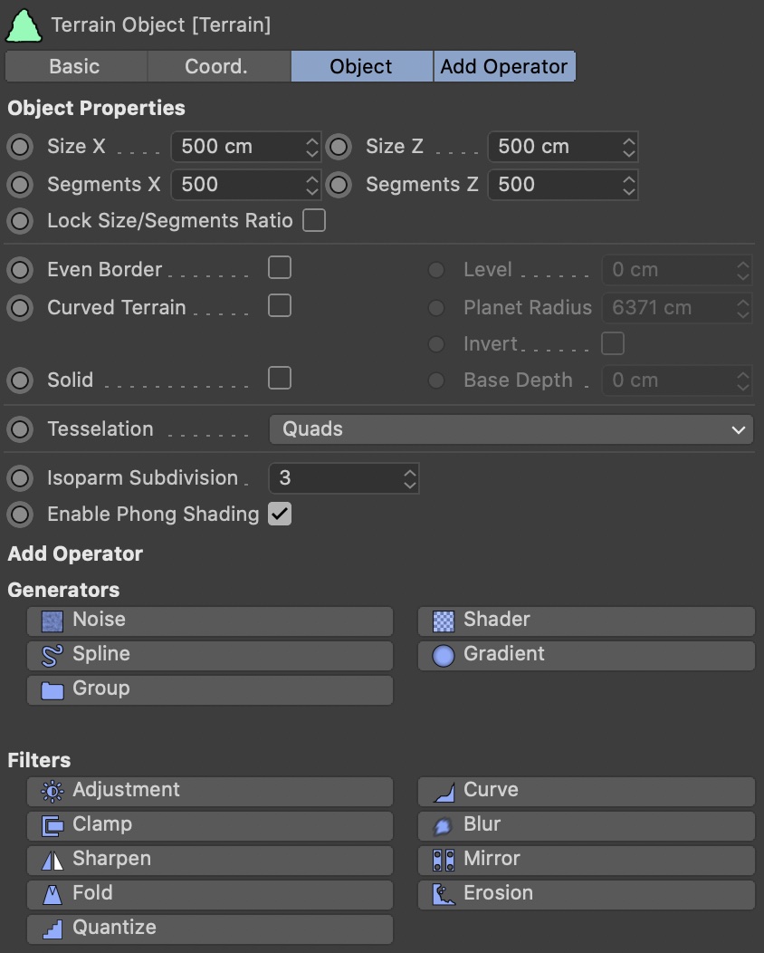
Size X/Z
Defines the size of the terrain in real-world units.
Segments X/Z
Here you define the resolution of the terrain. Larger values will produce more detailed results, but also take longer to build and eat up more memory.
The maximum value possible defaults to 5000 (a subdivision of 5000x5000 will result in a terrain with 25 million polygons), but you can change the maximum in the Terraform4D preferences.
Lock Size / Segments Ratio
Enable this to lock the ratio between terrain size and segments.
If this option is enabled, changing the X or Z size will also change the respective X or Z segments, so the amount of segments per world unit remains constant.
Even Border
If you want the borders of the terrain to be flat (the standard C4D Landscape object calls this ‘Border At Sea Level’), enable this option.
Level
Set the desired altitude of the even borders here.
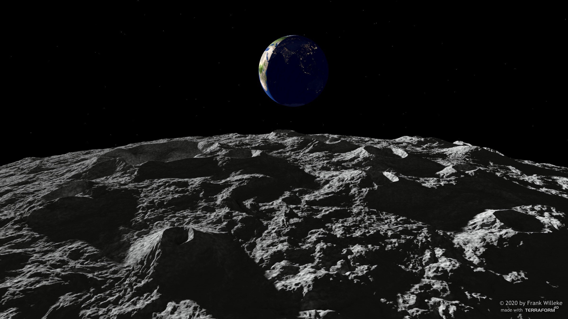
Curved Terrain
You can increase realism or very large-scale terrains by creating a curved terrain, resembling the curved surface and horizon of an actual planet. To do this, enable this option.
Note that this option is not meant to create actual spherical planets with seamless height maps. It just curves the terrain and will start looking odd if the radius gets too small.
Planet Radius
This is the radius of the planet. Default is earth's radius (6378 units).
Invert
Enable this to project the terrain on the inside of a planet, rather than on the outside.
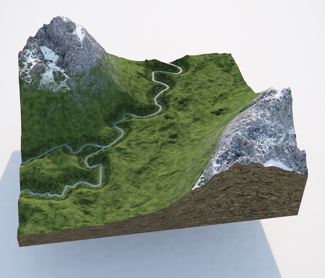
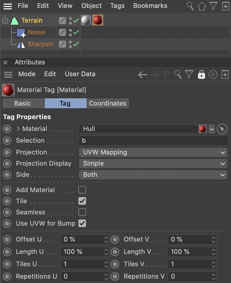
Solid
Enable this option to add a solid base arond the terrain, giving the impression it was ‘sliced’ from a larger landscape.
To texture the hull, apply a second material to the Terrain Object and constrain it to the selection b.
The base comes with UV coordinates, which makes sedimental texturing very easy. Simply assign a material with sediment layers along V.
Solid Terrain can not be used together with ‘Curved Terrain’.
Base Depth
Set the depth of the solid base here.
Tesselation
By default, the terrain geometry is subdivided into quadrangles. Alternatively, you can choose triangles in two orientations.
Isoparm Subdivision
Defines the number of isoparms used to display the terrain when isoparm viewport display mode is active.
Enable Phong Shading
Disable this to disable soft-shading for the terrain geometry.
Add Operator
If you click any of these buttons, a new operator object of the selected type is created and inserted as a child of the Terrain Object at the bottom of the operator stack.
Tab ‘Basic’
Export Mode & Export Bitmap...
The Terrain Object has the ability to export the terain as normalized 32-bit floating point TIFF, for use in shaders, materials, or even other applications.
You can choose to export the height map, or the slope map.
Memory usage
In the Basic tab of the Terrain Object, you can see the memory usage of the terrain setup. The memory usage is approximated from the size of all participating operators and their data structures, as well as the resulting geometry.